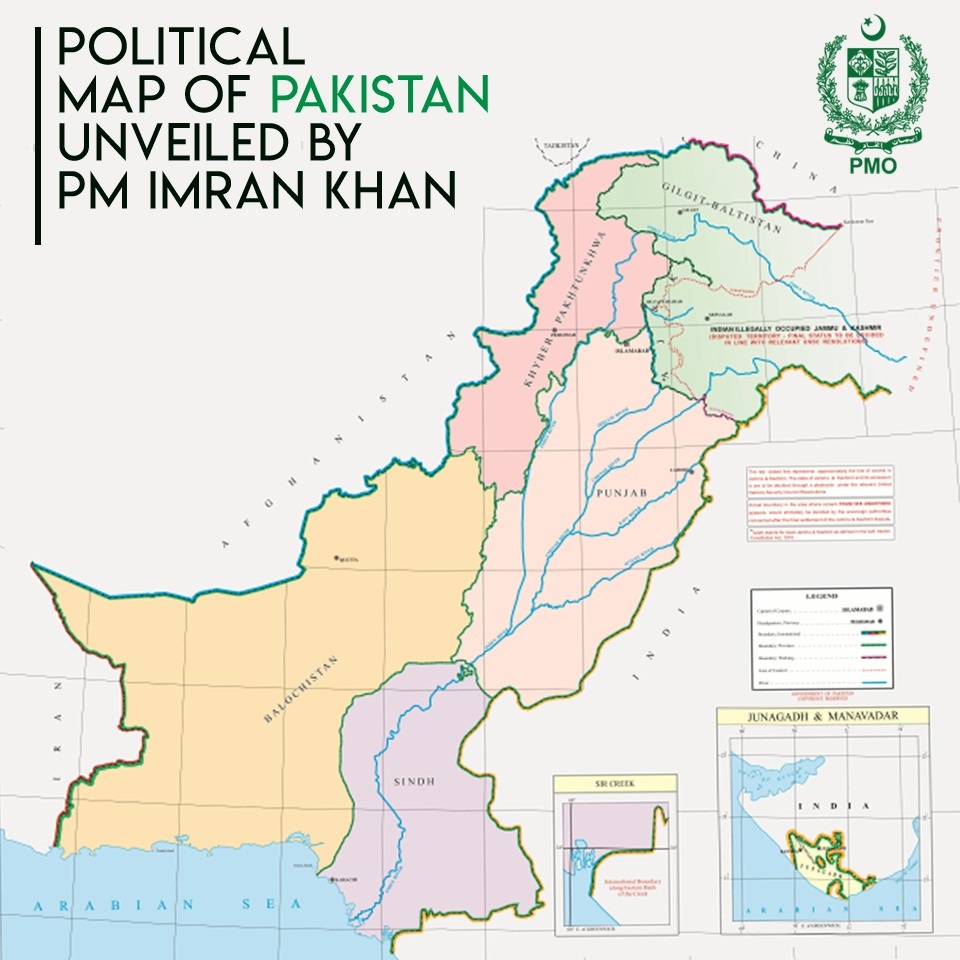
Islamabad: Pakistan Prime Minister Imran Khan unveiled a new “political map of Pakistan” that counts Jammu and Kashmir and Junagadh in Gujarat as its territories.
The move came on the eve of the first anniversary of the revocation of the contentious Article 370 and Article 35A in Kashmir.
The Imran Khan cabinet approved the new map in which the complete Jammu and Kashmir, is shown integrated with Pakistan.
The illegal map shows J&K as “Indian illegally occupied J&K — disputed territory — final status to be decided in line with relevant UNSC resolutions.” Thereby cocking a snook at the Govt of India.
“This is the most historic day in Pakistan’s history,” he said while addressing a news conference after chairing the meeting of the federal cabinet, which approved the new map.
India’s foreign ministry dissed Imran Khan’s Pakistan for its obsession with territorial aggrandisement supported by cross-border terrorism.
“This is an exercise in political absurdity, laying untenable claims to territories in the Indian State of Gujarat and our Union Territories of Jammu and Kashmir, and of Ladakh. These ridiculous assertions have neither legal validity nor international credibility,” external affairs ministry spokesperson Anurag Srivastava said in a brief statement.
“In fact, this new effort only confirms reality of Pakistan’s obsession with territorial aggrandisement supported by cross-border terrorism,” Srivastava said, referring to the ‘so-called political map’ released by Imran Khan.
An Indian official had earlier described Islamabad’s effort to publish the document as a “cartographic hallucination”.